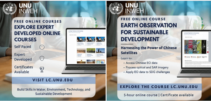
Learners, students, researchers and professionals seeking to develop practical skills in water, environmental sustainability, geospatial technology and sustainable development can access a range of free online courses through the United Nations University Institute for Water, Environment and Health (UNU-INWEH) Learning Centre.
The courses are self-paced and developed by experts to help learners understand and apply knowledge relevant to some of today’s major sustainability challenges. Areas covered include Earth observation, geospatial data analysis, drought assessment, spatial data management, satellite data analysis, surface water monitoring and flood mapping.
For students and professionals in the Global South, these courses provide an opportunity to strengthen technical and environmental knowledge online without the cost of conventional professional training.
About the UNU-INWEH Learning Centre
The United Nations University Institute for Water, Environment and Health is part of the United Nations University system and focuses on research, capacity development and knowledge related to global water and environmental challenges.
Its Learning Centre provides online learning opportunities designed to help participants build knowledge and practical skills in areas connected to water, the environment, technology and sustainable development.
The courses highlighted by UNU-INWEH can be particularly useful for people interested in the growing role of geospatial data, satellite technology, artificial intelligence and environmental monitoring in sustainable development.
1. Earth Observation for Sustainable Development
The Earth Observation for Sustainable Development course introduces learners to the use of Earth observation technologies in addressing development and environmental challenges.
Earth observation allows researchers and practitioners to collect information about the Earth’s surface and changing environmental conditions through satellites and other technologies.
These capabilities are increasingly used for monitoring land, water resources, agriculture, ecosystems, climate-related changes and other sustainability issues.
The course may therefore be relevant to learners studying geography, environmental science, climate change, development studies, natural-resource management and related disciplines.
2. Geospatial Data Analysis with ChatGPT and Google Earth Engine
Another course focuses on Geospatial Data Analysis with ChatGPT and Google Earth Engine, combining geospatial analysis with emerging artificial intelligence tools.
Google Earth Engine provides access to large collections of satellite and geospatial datasets, while AI tools such as ChatGPT can support research workflows, data interpretation and technical tasks.
This course can be useful for students and professionals interested in GIS, remote sensing, data science, artificial intelligence and environmental research.
The growing intersection between AI and geospatial technologies also makes this area relevant to learners seeking to develop modern digital skills for environmental and development-related careers.
3. Spatiotemporal Drought Assessment
Drought can affect food production, water availability, ecosystems, livelihoods and communities.
The Spatiotemporal Drought Assessment course focuses on approaches for examining drought across different geographical areas and periods.
Understanding how drought develops and changes over time can support environmental monitoring, climate adaptation, agricultural planning, water management and disaster-risk reduction.
Students, researchers and professionals working in climate resilience, environmental science, agriculture and water resources may find this area particularly relevant.
4. Spatial Data Management
The Learning Centre also offers a course on Spatial Data Management, an important area for anyone working with geographic information.
Spatial datasets are widely used in environmental research, urban planning, infrastructure development, natural-resource management and humanitarian programmes.
Building an understanding of how spatial data is organised and managed can therefore complement practical GIS and geospatial analysis skills.
The course can be relevant to GIS students, researchers, development practitioners, environmental professionals and others who regularly work with geographical datasets.
5. Satellite Data Analysis for Surface Water and Flood Mapping
The Satellite Data Analysis for Surface Water and Flood Mapping course focuses on using satellite information to analyse surface water and map flooding.
Satellite imagery can provide valuable information for monitoring water bodies and identifying areas affected by floods, including locations where conventional field-based data collection may be difficult.
Knowledge in satellite-based water and flood analysis can be useful in fields such as hydrology, disaster management, environmental monitoring, climate adaptation, water-resource management and humanitarian response.
Who Can Take the Courses?
The UNU-INWEH Learning Centre opportunities may benefit a broad range of learners, including:
- University students and recent graduates.
- Researchers and academics.
- GIS and remote-sensing practitioners.
- Environmental professionals.
- Water-resource specialists.
- Climate and sustainability practitioners.
- Development professionals.
- Disaster-risk and resilience practitioners.
- Data analysts.
- Professionals seeking additional digital skills.
Because the courses are self-paced, learners can study the available material according to their own schedules.
Free Access and Certificates
A major feature of the learning opportunities is that they are free to access.
The UNU-INWEH announcement also indicates that certificates are available. This gives learners an opportunity to document their participation and add relevant learning achievements to their CVs, professional portfolios or LinkedIn profiles.
Learners should check the requirements for individual courses to understand how certificates are issued.
Why These Skills Matter
Environmental and development organisations increasingly rely on digital technologies and data to understand complex sustainability challenges.
Skills in GIS, Earth observation, satellite imagery, spatial data management, drought monitoring and AI-supported geospatial analysis can complement academic qualifications and professional experience in environmental science, geography, development studies, climate studies, engineering and related fields.
For learners who cannot easily access expensive training programmes, free online learning can provide a flexible way to develop additional technical knowledge from anywhere with internet access.
How to Register
Interested learners can visit the UNU-INWEH Online Learning Centre and explore the available courses.
Participants can select courses according to their interests and professional development goals. Since the programmes are self-paced, learners can work through the material at a time and pace that suits them.
Before beginning a course, applicants should review the latest information provided by UNU-INWEH regarding registration, course content and certificate requirements.
Key Details
- Institution: United Nations University Institute for Water, Environment and Health (UNU-INWEH)
- Format: Online
- Cost: Free
- Learning mode: Self-paced
- Certificates: Available
- Main fields: Water, environment, GIS, Earth observation, satellite data and sustainable development
- Highlighted courses: Five
- Target audience: Students, researchers and professionals
- Location: Online
Final Thoughts
The UNU-INWEH Learning Centre offers learners an opportunity to build knowledge in areas connecting environmental sustainability, water management, geospatial technologies and emerging digital tools.
With courses covering Earth observation, AI-supported geospatial analysis, drought assessment, spatial data management and satellite-based flood mapping, the programme can complement academic studies and professional development across several environmental and development fields.
Learners interested in strengthening their technical skills can explore the available courses and register through the official UNU-INWEH Online Learning Centre.