Learn drought monitoring, satellite data analysis and Google Earth Engine through UNU-INWEH’s free online course for water, disaster management and geospatial professionals.
Professionals and postgraduate students interested in climate change, water resources and disaster risk management can strengthen their technical skills through a free online course offered by the United Nations University Institute for Water, Environment and Health (UNU-INWEH).
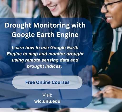
The course, Drought Monitoring with Google Earth Engine, introduces participants to practical methods for monitoring drought using satellite data, remote sensing, drought indices and cloud-based geospatial technologies.
Designed for learners interested in understanding drought patterns and identifying vulnerable areas, the course explores how geospatial tools can support environmental monitoring, water management and disaster preparedness.
Participants will gain exposure to techniques for analyzing drought conditions across different locations and periods, processing geospatial datasets in the cloud and identifying drought hotspots using statistical methods.
The opportunity may be particularly useful for professionals working in water resource management, environmental science, climate research, agriculture and disaster risk reduction, as well as postgraduate students seeking to expand their knowledge of remote sensing and geospatial analysis.
Course Overview
- Course title: Drought Monitoring with Google Earth Engine
- Provider: United Nations University Institute for Water, Environment and Health (UNU-INWEH)
- Learning format: Online
- Course fee: Free, according to the supplied announcement
- Subject areas: Drought monitoring, remote sensing, geospatial analysis, climate resilience and water management
- Target audience: Drought, water and disaster management professionals, and postgraduate students interested in remote sensing, big data and cloud computing
- Registration: Through the UNU-INWEH Online Learning Centre
The supplied announcement does not specify a registration deadline, course duration, certificate availability or prior technical requirements. Prospective learners should check the official course page for these details.
What Will Participants Learn?
1. Apply drought indices
Participants will be introduced to drought indices used to assess and monitor drought conditions. These indicators help researchers and practitioners interpret environmental data and understand variations in drought severity across different areas and periods.
Understanding drought indices can support the assessment of water availability, agricultural vulnerability and environmental stress.
2. Conduct spatiotemporal and time-series analysis
The course introduces techniques for examining drought across space and time. Spatiotemporal analysis helps identify where drought conditions occur, while time-series analysis allows users to examine changes in drought indicators over time.
These approaches can help practitioners investigate recurring drought patterns, seasonal variations and changes in drought conditions.
3. Identify drought hotspots using zonal statistics
Participants will learn about zonal statistics, a method for summarising spatial data within defined geographical areas.
This technique can help identify locations experiencing severe drought conditions and compare drought indicators across administrative boundaries, watersheds or other geographical zones.
Such information can support decisions about where to prioritise water management interventions, agricultural assistance and disaster response.
4. Process geospatial data in the cloud
The course introduces cloud-based geospatial processing using Google Earth Engine, a platform designed to analyse large collections of satellite imagery and other Earth observation datasets.
Cloud computing can reduce the need to download and process extensive datasets on local computers, making it easier to conduct large-scale environmental analyses.
These skills are increasingly relevant to professionals working with satellite observations, climate data, environmental monitoring and geographical information systems.
Who Should Take This Course?
The course is designed for drought, water and disaster management professionals, as well as postgraduate students interested in remote sensing, big data and cloud computing.
It may also be relevant to individuals working or studying in fields such as:
- Environmental science and natural resource management
- Climate change adaptation and resilience
- Hydrology and water resource planning
- Agricultural monitoring and food security
- Disaster risk reduction and emergency preparedness
- Geographic Information Systems (GIS) and remote sensing
- Climate research and geospatial data analysis
For professionals in drought-prone regions, these technical skills can help strengthen the evidence available for monitoring environmental conditions and planning appropriate responses.
Applicants should check the course description for any recommended prior knowledge of geospatial technologies, programming or Google Earth Engine.
Drought can affect agricultural production, water supplies, ecosystems and livelihoods. Monitoring its development is important for identifying vulnerable areas and supporting timely interventions.
Satellite data provide information about environmental conditions over large geographical areas, while drought indices and statistical techniques help transform these observations into information that can support decision-making.
Google Earth Engine provides tools for analysing extensive Earth observation datasets through cloud-based computing. Learning to use these tools can help participants develop practical geospatial analysis skills relevant to research, environmental management and climate resilience.
For postgraduate students, the course may also provide useful technical foundations for research involving drought patterns, land conditions, water availability and climate-related risks.
How to Register
Interested learners can follow these steps:
- Visit the official UNU-INWEH website.
- Navigate to the UNU-INWEH Online Learning Centre.
- Search for Drought Monitoring with Google Earth Engine.
- Review the course description, eligibility requirements and learning arrangements.
- Follow the registration instructions provided on the official platform.
Before registering, confirm whether the course is currently accepting participants and check whether there are any completion requirements or additional technical prerequisites.
Final Thoughts
The free online course on Drought Monitoring with Google Earth Engine offers an opportunity for eligible learners to explore practical approaches to drought analysis using satellite data and cloud-based geospatial technologies.
By introducing drought indices, time-series analysis, zonal statistics and cloud-based data processing, the course can help participants build knowledge relevant to water management, climate research and disaster preparedness.
Professionals and postgraduate students interested in developing their remote sensing and environmental data analysis skills can explore the opportunity through the UNU-INWEH Online Learning Centre.