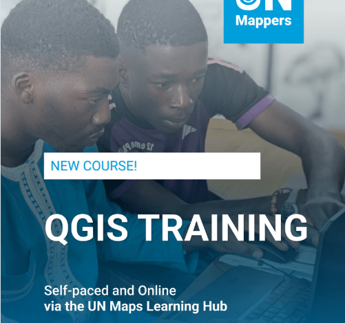
The United Nations Maps (UN Maps) Learning Hub has launched a free online QGIS Training Course, providing learners with an opportunity to develop practical Geographic Information System (GIS) and mapping skills using the open-source QGIS software.
The course is designed for individuals who want to understand the fundamentals of GIS, geospatial data and digital mapping while gaining practical experience through hands-on learning.
QGIS is widely used for creating maps, analysing spatial data and visualising geographic information. As GIS skills continue to be valuable across humanitarian response, development, environmental management, urban planning, agriculture and disaster risk reduction, the new UN Maps course provides an accessible entry point for learners interested in geospatial technologies.
UN Maps QGIS Training Course – Key Highlights
- Course: QGIS Training
- Provider: UN Maps Learning Hub
- Format: Online
- Cost: Free
- Software: QGIS
- Level: Beginner-friendly
- Focus: GIS, QGIS, geospatial data, mapping and data analysis
- Website: UN Maps Learning Hub
What Will You Learn?
The course introduces participants to the core concepts required to begin working with GIS and QGIS.
Learners will start by developing an understanding of Geographic Information Systems, QGIS and geospatial data. This foundation is important for anyone who has little or no previous experience with digital mapping.
The training then moves into practical mapping exercises, allowing participants to apply the concepts they have learned.
Build Your First Map
One of the practical components of the training is learning how to create a first map using QGIS.
Participants can gain experience working with geographic information and presenting it visually. Creating maps is an important GIS skill that can help transform complex datasets into information that is easier to understand and communicate.
The practical nature of the training makes it suitable for learners who want to move beyond theoretical knowledge and begin experimenting with GIS tools themselves.
Data and Map Analysis
The QGIS training also introduces learners to data and map analysis.
GIS analysis can help users identify spatial patterns, compare locations and understand relationships between geographic features and datasets.
These skills can be applied across numerous fields, including humanitarian operations, public health, climate action, environmental conservation, infrastructure planning, agriculture and international development.
By learning how to analyse geographic information, participants can strengthen their ability to use data to support evidence-based decision-making.
Real-World GIS Examples
The course also explores real-world examples, helping learners understand how GIS and mapping technologies can be applied beyond the classroom.
Real-world applications demonstrate how geospatial information can support planning, monitoring and decision-making in different contexts.
For development professionals, researchers, students and humanitarian practitioners, understanding these applications can provide useful insight into how mapping contributes to practical problem-solving.
Who Should Take the Course?
The UN Maps QGIS Training Course can be useful for students, researchers, development professionals, humanitarian workers, environmental practitioners, planners and anyone interested in GIS and geospatial technology.
Because the course covers the basics of GIS and QGIS, it can also be a suitable starting point for people who are new to geographic information systems.
Those who already have some GIS experience may also find the training useful for strengthening their understanding of QGIS and exploring additional applications of the software.
Why Learn QGIS?
QGIS is a free and open-source GIS platform, making it accessible to learners who want to develop geospatial skills without purchasing expensive proprietary software.
Learning QGIS can also complement skills in data analysis, research, mapping and visualisation.
For professionals working on development and humanitarian projects, GIS knowledge can be particularly valuable because geographic data can help identify needs, map resources, monitor projects and communicate information to stakeholders.
Start Learning for Free
The UN Maps Learning Hub course provides learners with an opportunity to begin developing GIS skills at no cost.
Interested participants can access the training through the official UN Maps Learning Hub and begin exploring the fundamentals of QGIS, geospatial data, mapping and spatial analysis.